Construction of the Kinzua Dam
Repost from Bob Schmid Facebook Page
“I paired these two neat aerial photographs together, as they somewhat are similar views that match up relatively close to reach other. The left photo -Old view- was taken closer, while the right photo -present day view- was taken a little further away, but just enough to give you a decent comparison.
1961 (May) Aerial View, looking up Wolf Run Valley, seen way in the background, where you can see the original Wolf Run Road. The Allegany River is flowing along the left side of this view.
The area that was once an early Seneca settlement known as “Oldtown”, is seen near the foreground (entire bottom portion). “Oldtown” was an early Seneca settlement, which is all underwater now, from the Allegany Reservoir.
The area from this Wolf Run Valley, all the way to the left side of this aerial photo, is all Allegany State Park.
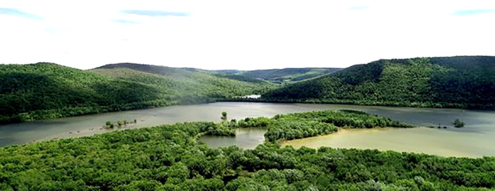
Seen in the aerial view pictured to the shows a modern view of what this exact same area looks like today. This here is a Beautiful aerial view of the area that was once an early Seneca settlement known as “Oldtown”. This modern aerial view has total Credit & Courtesy goes to the Seneca Nation of Indians for this magnificent photograph.”