
Seneca Nation Notice to the Public
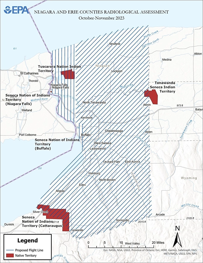
At the request of the New York State Department of Conservation, the US EPA will be conducting an airplane (aerial) survey starting October 2023 of Niagara and Erie Counties, and will include the air space above the Buffalo Creek, Niagara Falls, and portions of the Cattaraugus Territories.
The flyovers will be to identify potential radiation contamination. The EPA will be searching for potential sources of contamination that is believed to be the result of historic industry/manufacturing operations, and the development of the first atomic weapons during World War II.
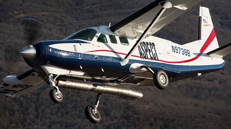
A three-member crew will fly a Cessna 204B aircraft equipped with advanced technology to detect radiation over 1,600 square miles in Niagara and Erie counties (see map below). Notice, that the aircraft will fly at a low-level altitude, approximately 500-feet above the ground, in a linear grid pattern. The aircraft may be noticeable with US EPA and ASPECT (Airborne Spectral Photometric Environmental Collection Technology) markings. EPA expects the survey to take one month to complete, depending on weather conditions.
The information collected will be reviewed by EPA and the NYSDEC, who will work together to determine potential follow-up work that may be needed including ground-based surveys and sampling.